Hardoi Master Plan / Regulated Area Map PDF 2011
The Hardoi Master Plan serves as a roadmap for the city’s future development, ensuring that urban expansion is organized, sustainable, and inclusive. By focusing on infrastructure, housing, transport, economic growth, and environmental conservation, the plan aims to transform Hardoi into a progressive and well-developed urban center in Uttar Pradesh. With effective implementation and community participation, Hardoi is on a path to achieving balanced urbanization while preserving its historical and cultural essence.
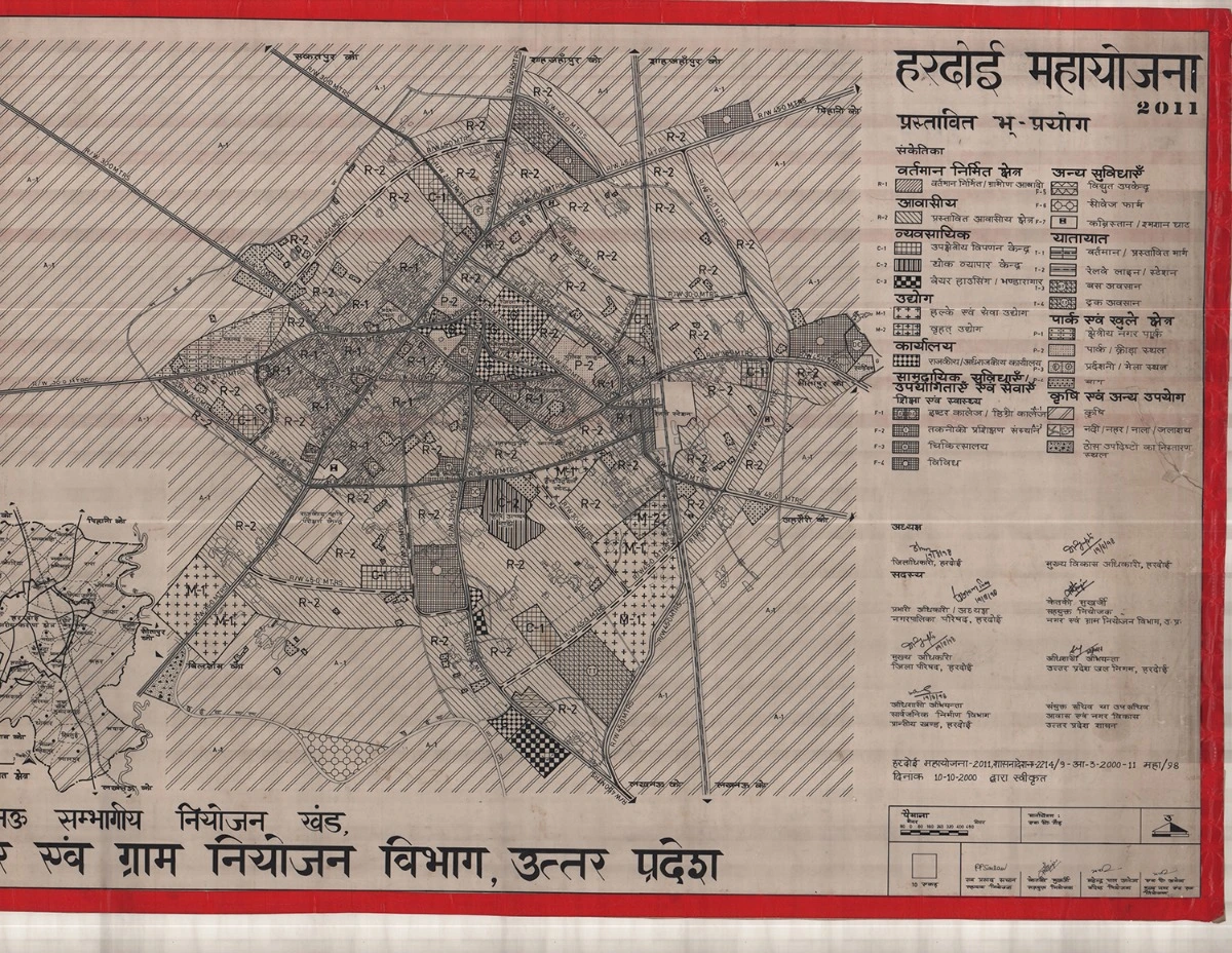
Features of Hardoi Master Plan
The Hardoi Master Plan 2011 focuses on planned urban growth, road infrastructure development, public amenities, and environmental sustainability. Some of its main objectives include:
- Residential Development
- Planned housing sectors to accommodate the growing population.
- Development of affordable housing schemes for low and middle-income groups.
- Expansion of urban amenities like water supply, sewage systems, and electricity infrastructure.
- Road & Transport Connectivity
- Strengthening SH-25 & SH-21 for smooth intercity travel.
- Expansion of internal road networks for improved urban mobility.
- Enhancing connectivity with railway and public transport services.
- Commercial & Economic Growth
- Promotion of business hubs like Railwayganj and Sadar Bazar.
- Development of modern retail complexes, wholesale markets, and small-scale industries.
- Encouragement of local artisans and traditional industries to boost employment.
- Public Infrastructure & Social Services
- Establishment of hospitals, schools, and civic centers for better public services.
- Development of police stations, fire stations, and government offices.
- Enhancement of sanitation, drainage, and solid waste management facilities.
- Environmental Sustainability
- Expansion of green belts, parks, and eco-sensitive zones.
- Implementation of rainwater harvesting and water conservation projects.
- Strict pollution control measures to maintain environmental balance.
Planned Development & Regulation
Recognizing the need for structured urban expansion and infrastructure planning, the Uttar Pradesh government declared Hardoi Nagar Palika and 41 revenue villages as a regulated area under Section 3(1) of the UP Regulation of Building Operations Act, 1958, on June 28, 1986. This move aimed to prevent unorganized construction, encourage systematic development, and enhance the quality of life for the town’s residents.
Currently, the Hardoi Master Plan 2011 is in effect for the regulated area, covering an extensive 16,607 hectares of land. This plan includes zoning regulations, urban infrastructure planning, road networks, and public utilities to ensure holistic and sustainable urban development.