Saharanpur Draft Master Plan 2031 PDF with Landuse along Ring Road / Bypass Map
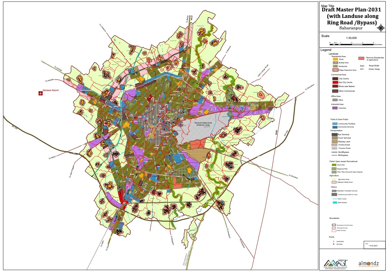
Saharanpur, one of the key cities in Uttar Pradesh, is set for a transformative urban expansion under the Saharanpur Master Plan 2031. This plan, approved by the Saharanpur Development Authority (SDA), aims to enhance infrastructure, regulate land use, and promote sustainable development while ensuring economic growth.
With the city’s area expanding to 297 square kilometers, including 31 newly added villages, the plan lays a strong foundation for organized urbanization. The master plan reserves 12,481.79 hectares for residential, industrial, commercial, and public use, ensuring a balanced approach to growth while maintaining agricultural land integrity.
Land Use Distribution Under Saharanpur Master Plan 2031
A structured land use pattern has been introduced to balance residential, commercial, industrial, and public utility spaces.
| Land Use Category | Area (Hectares) |
|---|---|
| Industrial | 996.99 |
| Residential | 5,532.39 |
| Office Space | 86.56 |
| Commercial | 485.87 |
| Transport & Roads | 2,245.19 |
| Public & Semi-Public Use | 862.51 |
| Parks & Open Spaces | 2,229.53 |
| Other Uses | 42.75 |
| Total Urban Development Area | 27,481.79 hectares |