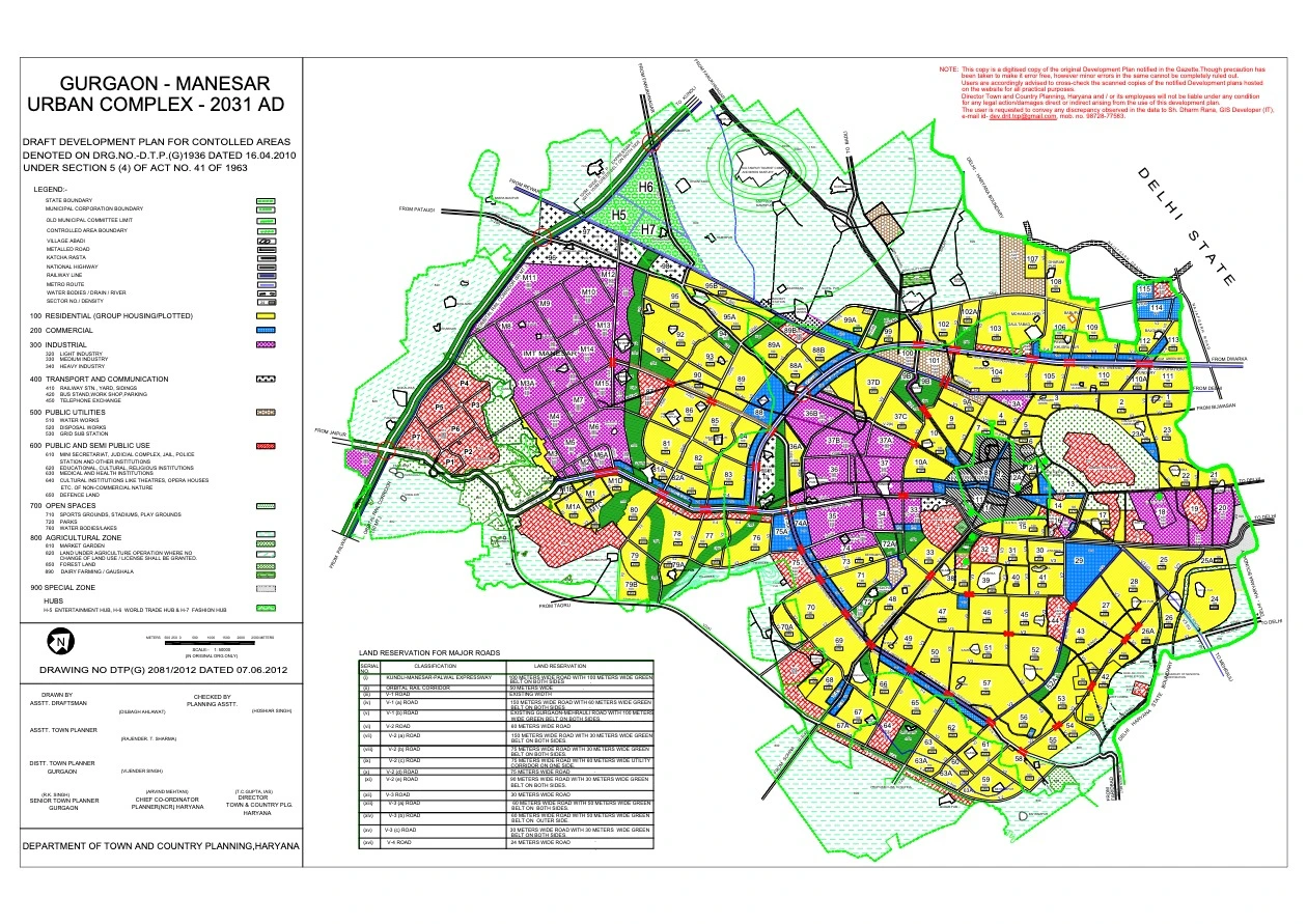
Gurgaon Master Plan 2031 PDF – Gurgaon Manesar Urban Complex 2031 AD Map
Master Plans
,
Haryana Master Plans
,
Gurugram
,
Haryana
0.84 MB /
1 Pages
1 LIKES
like
SHARE THIS
Share
DMCA / REPORT
Report
Download Gurgaon Master Plan 2031 PDF – Gurgaon Manesar Urban Complex 2031 AD Map
Free Download
copy url
Welcome to MasterPlansIndia!
Convert PDF to Image
Categories
Popular Topics
About
Contact
Privacy Policy
Disclaimer
DMCA / Report Content