Hayathnagar Master Plan 2031 HMDA Rangareddy PDF Map
The HMDA Master Plan 2031 for Hayathnagar is a strategic blueprint to regulate urban expansion, industrial growth, and infrastructure development. It aims to enhance connectivity, sustainability, and quality of life for residents while preserving green spaces and heritage sites. This planned development will ensure Hayathnagar’s transformation into a well-integrated urban hub within the Hyderabad Metropolitan Region (HMR).
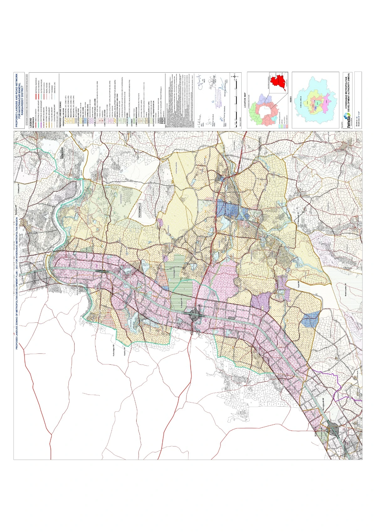
Proposed Land Use for Hayathnagar Mandal
| Category | Development Plans |
|---|
| Residential Zones | - Development of planned residential layouts to accommodate the rising population.
- Expansion of affordable housing for low and middle-income groups.
- Promotion of integrated townships with modern civic amenities.
- Redevelopment of existing urban settlements for better infrastructure.
|
| Commercial Zones | - Designation of business districts, shopping complexes, and trade hubs.
- Expansion of commercial corridors along major highways.
- Development of mixed-use zones integrating commercial and residential activities.
|
| Industrial & Economic Zones | - Allocation of industrial corridors to promote manufacturing and logistics.
- Encouragement of agro-based industries to support the local economy.
- Establishment of eco-friendly industrial parks for sustainable development.
|
| Recreational & Open Spaces | - Expansion of public parks, green belts, and eco-sensitive zones.
- Development of sports complexes, cultural centers, and community halls.
- Conservation of natural landscapes and water bodies.
|
| Public & Semi-Public Use | - Construction of hospitals, educational institutions, and government offices.
- Strengthening public utility services, including sewage treatment and solid waste management.
- Establishment of libraries, community centers, and religious institutions.
|
Download Hayathnagar Master Plan 2031 HMDA Rangareddy PDF Map
Free Download