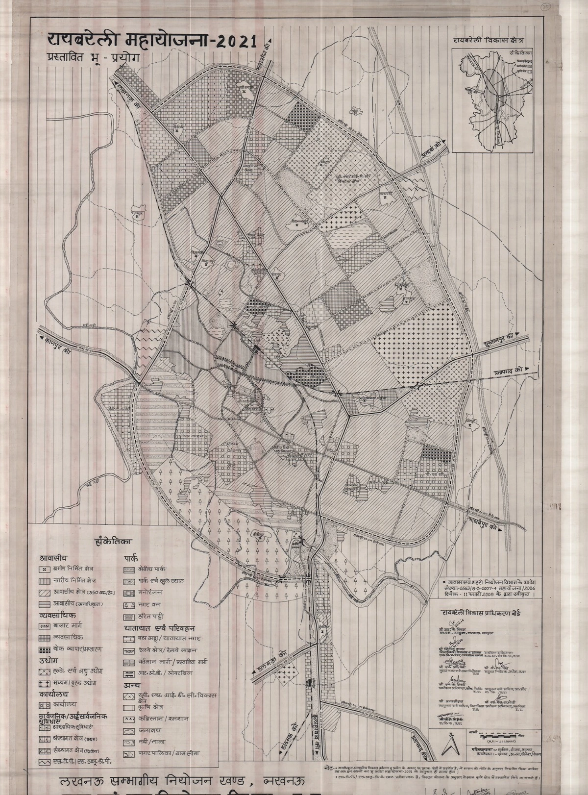
Raebareli Master Plan Map PDF 2021
The Raebareli Master Plan 2021 was formulated to promote sustainable and structured urban development while maintaining environmental integrity. With planned residential, commercial, and industrial expansion, along with improvements in infrastructure, transportation, and public amenities, the city is poised for balanced growth.
Raebareli Development Area: Planning & Implementation
- Formation of Regulated Area
The process of planned urban development in Raebareli began with the notification of the regulated area under G.O. No. 1738/XXXVII-III-64-MKV-73 dated August 28, 1973. Recognizing the need for a comprehensive development strategy, the Town and Country Planning Department was appointed as the nodal agency in 1972 to formulate a Master Plan for Raebareli.
- Master Plan 2001
The first master plan for the city was drafted and approved by the Government of Uttar Pradesh under G.O. No. 1214/37-3/19/NKV/76 on June 26, 1976. This plan laid the foundation for infrastructural improvements, zoning regulations, and urban expansion. However, with evolving urban dynamics, the need for an updated master plan became evident.
- Revision & Master Plan 2021
To accommodate Raebareli’s growing population and enhance urban infrastructure, the Raebareli Development Authority initiated the revision of Master Plan 2001 in its board meeting held on November 11, 2005. The Town and Country Planning Department, Uttar Pradesh, was again assigned as the nodal agency to prepare Master Plan 2021.
This updated master plan covered an area of 4,139.59 hectares and was designed to cater to a projected population of 3.5 lakh residents. It was officially notified under G.O. No. 5563/8-3-4maha/2006 on February 11, 2008.