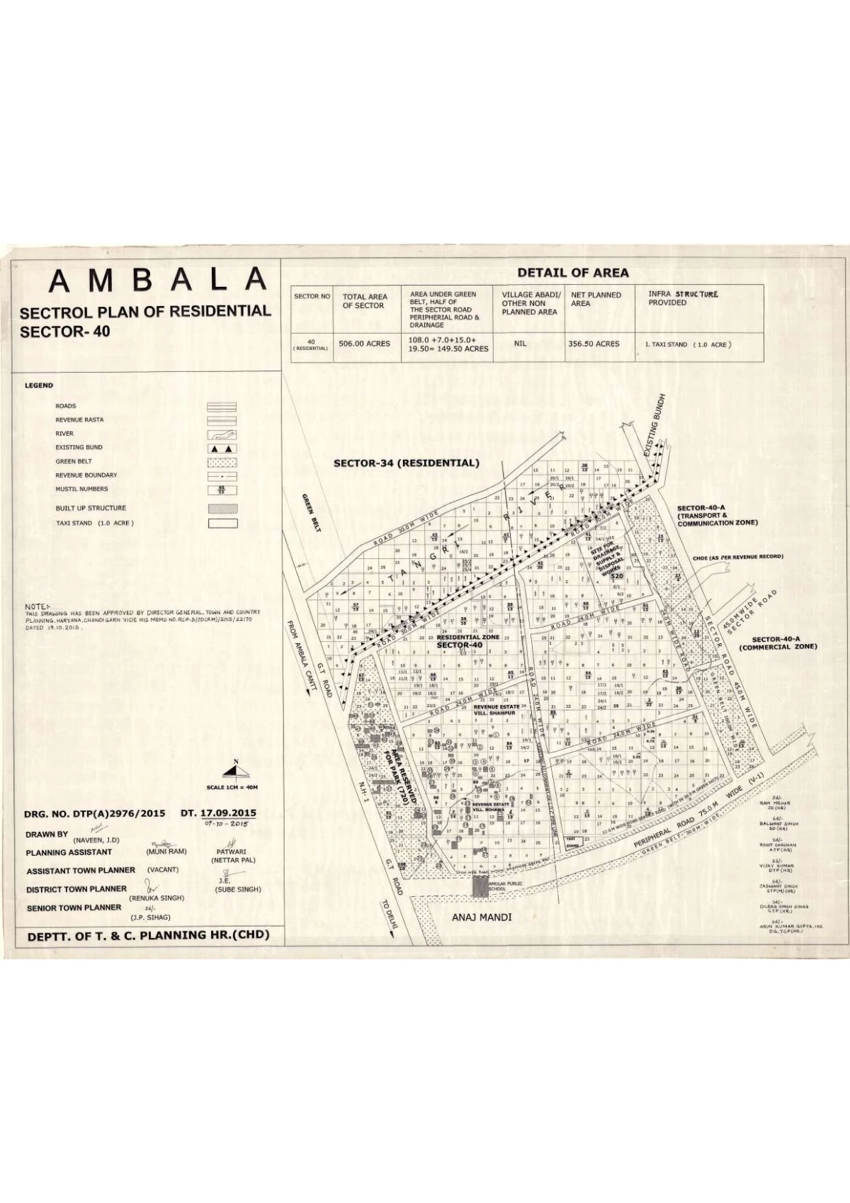
Sector 40 Ambala Sectrol Plan of Residential PDF Map
Ambala has a master plan map published that includes many sectors, roads, infrastructure proposals. The map aims to outline residential, market, institutional, green spaces, and transport infrastructure
Ambala Sectrol Plan of Residentail Sector 40 Details of Area
| Sector No. | Total Area of Sector | Area Under Green Belt + Half of Sector Road + Peripheral Road & Drainage + Village Abadi / Other Non-Planned Area | Net Planned Area | Infrastructure Provided |
|---|---|---|---|---|
| 40 (Residential) | 506.00 Acres | 108.00 + 7.00 + 15.00 + 19.50 = 149.50 Acres (Green Belt: 108.00, Half of Sector Road: 7.00, Peripheral Road & Drainage: 15.00, Village Abadi/Other: 19.50) | 365.50 Acres | I. Taxi Stand (1.0 ACRE) |