Wargal Master Plan 2031 – Proposed Land Use & Road Network Map PDF (Medak District)
The Wargal Master Plan 2031 is a strategic urban blueprint aimed at ensuring balanced land use, economic growth, and sustainable infrastructure. By integrating modern residential developments, commercial hubs, industrial parks, and a well-connected road network, Wargal is poised to become a key urban center in Medak District, offering a high quality of life for residents while fostering business and industrial expansion.
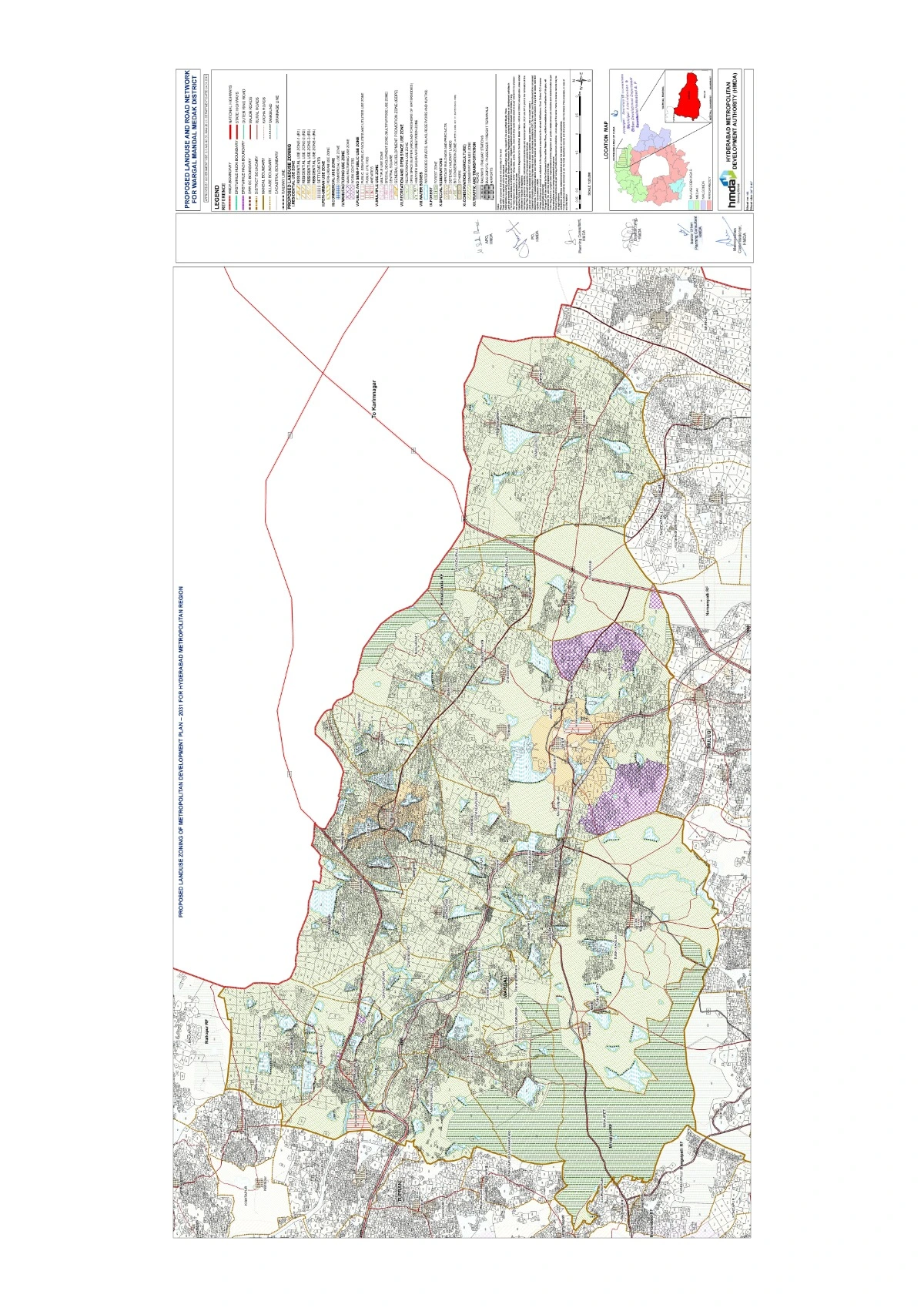
Proposed Land Use Zoning in Wargal Master Plan 2031
- Residential Zones
- Planned expansion of housing sectors to accommodate population growth.
- Development of affordable housing projects for various income groups.
- Integration of modern civic amenities such as water supply, sewage treatment, and electricity infrastructure.
- Establishment of gated communities and township projects for structured urban growth.
- Commercial & Economic Development
- Allocation of commercial hubs, business centers, and shopping complexes.
- Designation of wholesale markets and retail trade corridors for economic expansion.
- Development of mixed-use zones integrating commercial and residential areas.
- Encouragement of startups, IT parks, and financial institutions to boost employment.
- Industrial Zones
- Establishment of industrial corridors for manufacturing, logistics, and storage facilities.
- Development of eco-friendly industrial parks to reduce environmental impact.
- Promotion of agro-based industries and food processing units to support local farmers.
- Strengthening of warehousing and transport logistics sectors.
- Public & Institutional Use
- Construction of educational institutions, healthcare centers, and government offices.
- Expansion of public utilities, including waste management, water supply, and sewage treatment facilities.
- Development of community centers, cultural halls, and research institutes.
- Recreational & Green Spaces
- Establishment of parks, playgrounds, and green belts to improve environmental quality.
- Conservation and beautification of natural landscapes, lakes, and eco-sensitive zones.
- Implementation of sustainable development initiatives like rainwater harvesting and afforestation drives.
Proposed Road Network Development in Wargal Master Plan 2031
- Arterial & Sub-Arterial Roads
- Expansion of major arterial roads to facilitate seamless traffic flow.
- Strengthening of sub-arterial roads for efficient movement within residential and commercial zones.
- Highway & Bypass Roads
- Widening and upgradation of NH-44 (Hyderabad-Nagpur Highway) for improved regional connectivity.
- Construction of bypass roads to reduce congestion in the town center.
- Public Transport & Mobility
- Establishment of dedicated public transport corridors for buses and shared mobility services.
- Improvement of bus terminals, parking areas, and multi-modal transport facilities.
- Introduction of pedestrian-friendly walkways and cycling lanes to promote sustainable mobility.