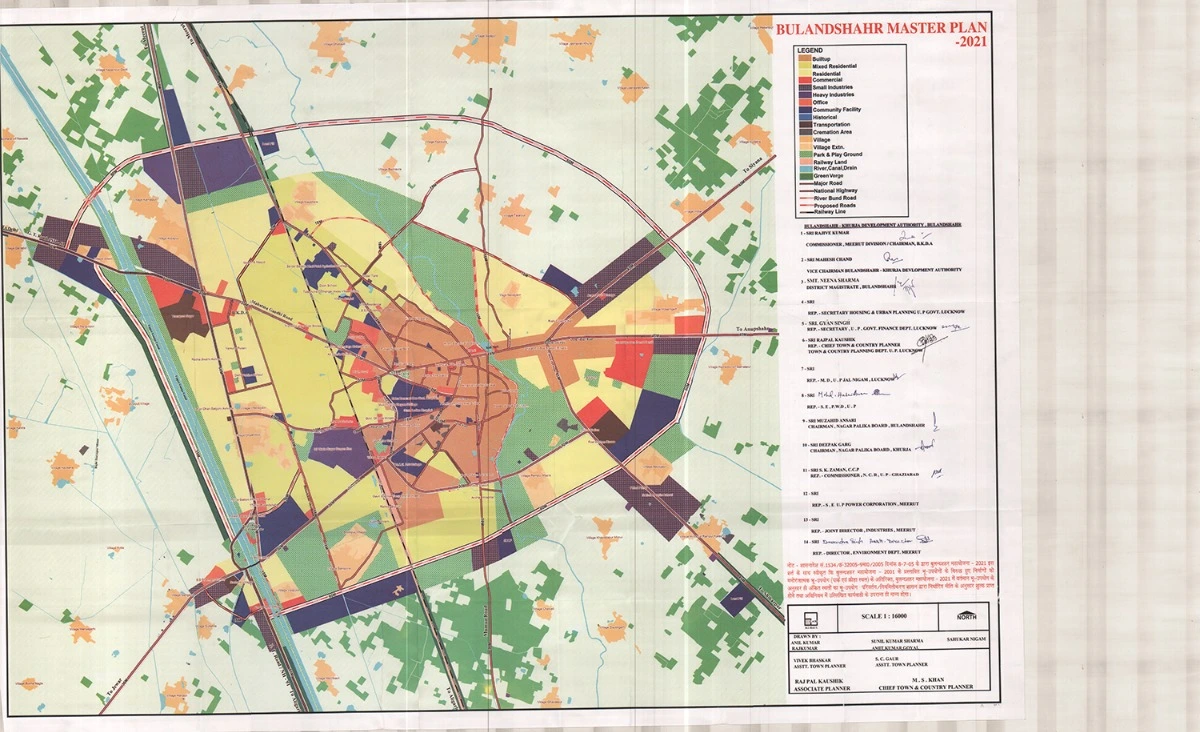
Bulandshahr Master Plan 2021 Development Area Map PDF
The Bulandshahr Master Plan 2021 aims to guide the planned urban development of Bulandshahr city by ensuring sustainable infrastructure, balanced land use, and improved connectivity. The master plan outlines zoning regulations, road networks, and land allocation to accommodate the projected population and future economic growth.
Bulandshahr Master Plan – Development Area Map, Land Use & Zoning Details
The Bulandshahr Master Plan 2021 outlines the development strategy for the city, focusing on planned urban expansion, infrastructure development, and environmental sustainability. The key aspects of the master plan include:
- Residential Development
- Expansion of planned housing sectors to accommodate the growing population.
- Development of affordable housing projects for low and middle-income groups.
- Integration of modern urban amenities such as water supply, drainage, and electricity.
- Industrial & Economic Growth
- Designation of industrial zones to promote manufacturing and logistics.
- Development of business hubs and commercial centers to boost trade and employment.
- Encouragement of agro-based and small-scale industries.
- Transport & Connectivity
- Expansion and widening of national and state highways for better regional connectivity.
- Development of bypass roads and flyovers to reduce urban congestion.
- Strengthening of public transport infrastructure, including bus terminals and railway station upgrades.
- Public Infrastructure & Social Services
- Establishment of new schools, colleges, and healthcare facilities.
- Development of police stations, fire stations, and government offices.
- Enhancement of sanitation, sewage, and solid waste management systems.
- Environmental & Sustainable Development
- Expansion of green belts, urban parks, and eco-sensitive zones.
- Implementation of rainwater harvesting and water conservation projects.
- Preservation of heritage sites and sustainable urban planning initiatives.