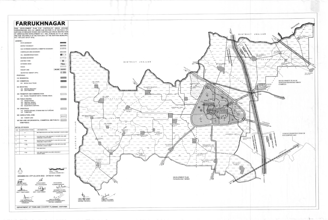
Farrukh Nagar Final Master Plan 2031 PDF Map
The Farrukh Nagar Final Master Plan 2031 outlines a comprehensive framework for the town’s development, aiming to accommodate a projected population of 125,000 by 2031. The plan encompasses an area of approximately 377 hectares and focuses on structured urban growth, infrastructure enhancement, and environmental sustainability.
Highlights of the Farrukh Nagar Master Plan 2031
- Residential Development: An 18-hectare area has been designated as Residential Sector 1, specifically reserved for low and medium-income groups, with a planned population density of 1,125 persons per hectare.
- Commercial Zones: Approximately 36.5 hectares have been allocated for commercial use across Sectors 1, 3, 4, and 8 to meet the town’s commercial needs.
- Industrial Areas: Sectors 6 and 7 have been earmarked for industrial purposes, covering about 64 hectares, to promote industrial growth and employment opportunities.
- Transportation Infrastructure: The plan proposes widening major roads connecting Farrukh Nagar to adjacent urban centers to 75 meters, accompanied by 30-meter green belts on both sides, enhancing connectivity and environmental aesthetics.
- Public Utilities: Around 40 hectares have been set aside for public utilities, including water works and grid substations, ensuring the provision of essential services to residents.